
Thank you for supporting this site ❤️
Make a donation
Make a donation
Gear up for your next adventure:
As an Amazon Associate, this site earns from qualifying purchases at no extra cost to you.
Begoro topographic map
Click on the map to display elevation.
Thank you for supporting this site ❤️
Make a donation
Make a donation
Gear up for your next adventure:
As an Amazon Associate, this site earns from qualifying purchases at no extra cost to you.
About this map
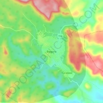
Name: Begoro topographic map, elevation, terrain.
Location: Begoro, Fanteakwa North District, Eastern Region, Ghana (6.34479 -0.41633 6.42479 -0.33633)
Average elevation: 1,614 ft
Minimum elevation: 1,201 ft
Maximum elevation: 2,316 ft
Thank you for supporting this site ❤️
Make a donation
Make a donation
Gear up for your next adventure:
As an Amazon Associate, this site earns from qualifying purchases at no extra cost to you.