
Thank you for supporting this site ❤️
Make a donation
Make a donation
Gear up for your next adventure:
As an Amazon Associate, this site earns from qualifying purchases at no extra cost to you.
Chaud topographic map
Click on the map to display elevation.
Thank you for supporting this site ❤️
Make a donation
Make a donation
Gear up for your next adventure:
As an Amazon Associate, this site earns from qualifying purchases at no extra cost to you.
About this map
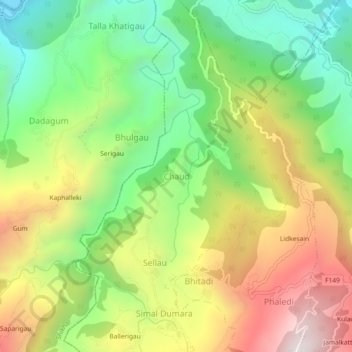
Name: Chaud topographic map, elevation, terrain.
Location: Chaud, K I Singh, Doti, Sudurpashchim Province, Nepal (29.19825 80.91018 29.23825 80.95018)
Average elevation: 3,363 ft
Minimum elevation: 1,768 ft
Maximum elevation: 5,453 ft
Thank you for supporting this site ❤️
Make a donation
Make a donation
Gear up for your next adventure:
As an Amazon Associate, this site earns from qualifying purchases at no extra cost to you.