

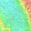
Erkrath topographic map
Click on the map to display elevation.
About this map

Name: Erkrath topographic map, elevation, terrain.
Location: Erkrath, Kreis Mettmann, Noordrijn-Westfalen, 40699, Duitsland (51.19275 6.87107 51.24253 6.99518)
Average elevation: 266 ft
Minimum elevation: -26 ft
Maximum elevation: 577 ft
Other topographic maps
Click on a map to view its topography, its elevation and its terrain.
Rijn
Duitsland > Noordrijn-Westfalen > Kreis Mettmann
Tijdens het Pleistoceen, vooral na het verdwijnen van de Baltische Rivier ongeveer één miljoen jaar geleden, heeft de Rijn in Midden en Noord-Nederland afzettingen neergelegd. In eerste instantie vooral ZO-NW door Limburg en Brabant richting West-Nederland, later meer Z-N door Oost+Nederland (Veluwe,…
Average elevation: 253 ft