
Thank you for supporting this site ❤️
Make a donation
Make a donation
Gear up for your next adventure:
As an Amazon Associate, this site earns from qualifying purchases at no extra cost to you.
Darigayos topographic map
Click on the map to display elevation.
Thank you for supporting this site ❤️
Make a donation
Make a donation
Gear up for your next adventure:
As an Amazon Associate, this site earns from qualifying purchases at no extra cost to you.
About this map
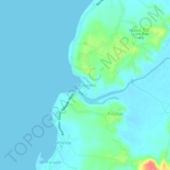
Name: Darigayos topographic map, elevation, terrain.
Location: Darigayos, Luna, La Union, Ilocos Region, Philippines (16.80044 120.31624 16.84044 120.35624)
Average elevation: 30 ft
Minimum elevation: -3 ft
Maximum elevation: 233 ft
Thank you for supporting this site ❤️
Make a donation
Make a donation
Gear up for your next adventure:
As an Amazon Associate, this site earns from qualifying purchases at no extra cost to you.