
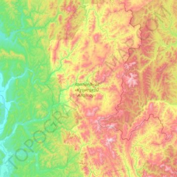
Kuznetsk Alatau Reserve topographic map
Interactive map
Click on the map to display elevation.
About this map
Name: Kuznetsk Alatau Reserve topographic map, elevation, terrain.
Average elevation: 2,339 ft
Minimum elevation: 502 ft
Maximum elevation: 6,010 ft
Other topographic maps
Click on a map to view its topography, its elevation and its terrain.
Zagadnoye
Russia > Kemerovo Oblast > Терсинское сельское поселение > Zagadnoye
Zagadnoye, Терсинское сельское поселение, Novokuznetsky District, Kemerovo Oblast, Siberian Federal District, Russia
Average elevation: 902 ft