
柯柯镇 topographic map
Interactive map
Click on the map to display elevation.
About this map
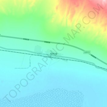
Name: 柯柯镇 topographic map, elevation, terrain.
Location: 柯柯镇, 乌兰县, 海西蒙古族藏族自治州, 青海省, 中国 (36.94672 98.21698 37.02672 98.29698)
Average elevation: 9,810 ft
Minimum elevation: 9,636 ft
Maximum elevation: 10,505 ft
Other topographic maps
Click on a map to view its topography, its elevation and its terrain.