
Wheelertown topographic map
Click on the map to display elevation.
About this map
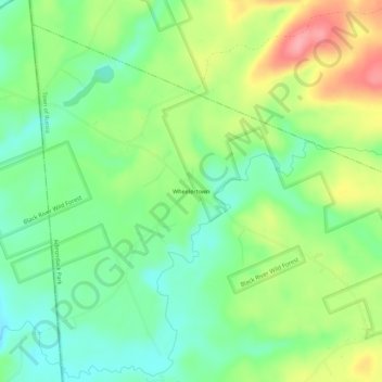
Name: Wheelertown topographic map, elevation, terrain.
Average elevation: 1,391 ft
Minimum elevation: 1,260 ft
Maximum elevation: 1,594 ft
Herkimer County trails, hiking, mountain biking, running and outdoor activities
Other topographic maps
Click on a map to view its topography, its elevation and its terrain.
Trenton Falls - Main Dam
United States > New York > Herkimer County > Town of Russia
Average elevation: 1,053 ft