Geolocate

Negra topographic map

Click on the map to display elevation.

About this map

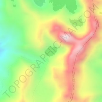
Name: Negra topographic map, elevation, terrain.

Location: Negra, Pacaipampa, Ayabaca, Piura, Perú (-5.06087 -79.48838 -5.05814 -79.48499)

Average elevation: 11,900 ft

Minimum elevation: 10,919 ft

Maximum elevation: 12,828 ft

Other topographic maps

Click on a map to view its topography, its elevation and its terrain.

La Ramada de Malache

Perú > Piura > Pacaipampa

Average elevation: 9,446 ft

Gear up for your next adventure:

Backpacking Tent - Lightweight and durable tent for multi‑day hikes
🪵Folding Camp Saw - Compact saw for wood and campsite work
🧢Outdoor Hiking Hat - Sun protection hat for outdoor explorers
📡GPS Antenna Upgrade - Enhance GPS reception in remote terrain
🔥Camping Stove - Portable stove for camping and backcountry cooking

As an Amazon Associate, this site earns from qualifying purchases at no extra cost to you.