
Thank you for supporting this site ❤️
Make a donation
Make a donation
Gear up for your next adventure:
As an Amazon Associate, this site earns from qualifying purchases at no extra cost to you.
Kooba topographic map
Click on the map to display elevation.
Thank you for supporting this site ❤️
Make a donation
Make a donation
Gear up for your next adventure:
As an Amazon Associate, this site earns from qualifying purchases at no extra cost to you.
About this map
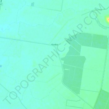
Name: Kooba topographic map, elevation, terrain.
Average elevation: 417 ft
Minimum elevation: 400 ft
Maximum elevation: 489 ft
Thank you for supporting this site ❤️
Make a donation
Make a donation
Gear up for your next adventure:
As an Amazon Associate, this site earns from qualifying purchases at no extra cost to you.
Other topographic maps
Click on a map to view its topography, its elevation and its terrain.
Sir Dudley de Chair Lookout
Australia > New South Wales > Griffith City Council > Griffith
Average elevation: 486 ft
Borland Leckie Park
Australia > New South Wales > Griffith City Council > Griffith
Average elevation: 413 ft