Geolocate

Torretta topographic map

Click on the map to display elevation.

About this map

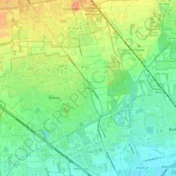
Name: Torretta topographic map, elevation, terrain.

Location: Torretta, Arese, Milano, Lombardia, 20044, Italia (45.53209 9.06923 45.57209 9.10923)

Average elevation: 538 ft

Minimum elevation: 479 ft

Maximum elevation: 607 ft

Gear up for your next adventure:

📚USA Hiking Guide Books - Top trail guides and map books
🗺️NatGeo Topo Maps - High-quality waterproof printed topographic maps of US Parks
📱Heavy-Duty Phone Cases - Drop-proof and waterproof protection for outdoor navigation
🗺️Topographic Maps - Detailed topo maps for hiking, exploring and outdoor navigation
🪶Survival Guide Book - Expert advice for emergency preparedness

As an Amazon Associate, this site earns from qualifying purchases at no extra cost to you.