
辖曼镇 topographic map
Interactive map
Click on the map to display elevation.
About this map
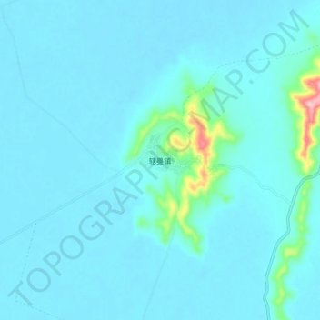
Name: 辖曼镇 topographic map, elevation, terrain.
Location: 辖曼镇, 若尔盖县, 阿坝藏族羌族自治州, 四川省, 624500, 中国 (33.68450 102.40515 33.76450 102.48515)
Average elevation: 11,312 ft
Minimum elevation: 11,260 ft
Maximum elevation: 11,890 ft
Other topographic maps
Click on a map to view its topography, its elevation and its terrain.