
Thank you for supporting this site ❤️
Make a donation
Make a donation
Gear up for your next adventure:
As an Amazon Associate, this site earns from qualifying purchases at no extra cost to you.
Cuarterón topographic map
Click on the map to display elevation.
Thank you for supporting this site ❤️
Make a donation
Make a donation
Gear up for your next adventure:
As an Amazon Associate, this site earns from qualifying purchases at no extra cost to you.
About this map
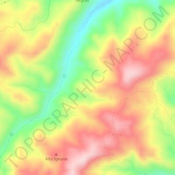
Name: Cuarterón topographic map, elevation, terrain.
Location: Cuarterón, Cervera del Río Alhama, Rioja, Spain (42.01133 -1.98788 42.03133 -1.96788)
Average elevation: 2,362 ft
Minimum elevation: 1,841 ft
Maximum elevation: 2,808 ft
Thank you for supporting this site ❤️
Make a donation
Make a donation
Gear up for your next adventure:
As an Amazon Associate, this site earns from qualifying purchases at no extra cost to you.