Geolocate

Gul topographic map

Click on the map to display elevation.

About this map

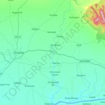
Name: Gul topographic map, elevation, terrain.

Location: Gul, Ambade, Chopda, Jalgaon, Maharashtra, India (21.16942 75.34949 21.32429 75.38086)

Average elevation: 702 ft

Minimum elevation: 472 ft

Maximum elevation: 1,870 ft

Gear up for your next adventure:

📚USA Hiking Guide Books - Top trail guides and map books
🥄Camping Utensil Set - Lightweight utensils for outdoor meals
🩹Survival Bandages - High‑quality bandages for emergencies
📱Solar Portable Charger - Solar power bank for charging devices off‑grid
🛌Ultralight Sleeping Bags - Compact down bags for cold nights in the wilderness

As an Amazon Associate, this site earns from qualifying purchases at no extra cost to you.