Geolocate

Alton topographic map

Click on the map to display elevation.

About this map

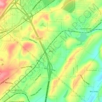
Name: Alton topographic map, elevation, terrain.

Location: Alton, Irondale, Jefferson County, Alabama, 35235, United States (33.55927 -86.65749 33.59927 -86.61749)

Average elevation: 794 ft

Minimum elevation: 597 ft

Maximum elevation: 1,010 ft

Jefferson County trails, hiking, mountain biking, running and outdoor activities

Gear up for your next adventure:

🦺Reflective Outdoor Gear - Safety gear for low‑light conditions
🧥Men's Rain Shells - Premium waterproof and breathable jackets for mountain weather
📡GPS Antenna Upgrade - Enhance GPS reception in remote terrain
🌡️Handheld Weather Meters - Measure wind, temp, and pressure for safe mountain travel
🧷Carabiner Set - Durable clips for gear attachment

As an Amazon Associate, this site earns from qualifying purchases at no extra cost to you.