Geolocate

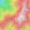
Kesennuma topographic map

Click on the map to display elevation.

About this map

Name: Kesennuma topographic map, elevation, terrain.

Location: Kesennuma, Miyagi Prefecture, Japan (38.62027 141.39876 39.00278 142.05136)

Average elevation: 299 ft

Minimum elevation: -3 ft

Maximum elevation: 2,861 ft

Other topographic maps

Click on a map to view its topography, its elevation and its terrain.

Mt. Suribachi

Japan > Furubira County > Furubira

Average elevation: 495 ft

Kirin fuji gotenba distillery

Japan > Sunto County > Gotenba

Average elevation: 2,041 ft

Akaishi Mountains

Japan > Shimoina District > Oshika

Average elevation: 8,501 ft

Gear up for your next adventure:

🎒Trail Energy Bars - High‑calorie bars for hiking energy
📡GPS Antenna Upgrade - Enhance GPS reception in remote terrain
🔦LED Headlamp - Bright and durable LED headlamp for night navigation
📷Action Cameras - Rugged cameras to document your journeys across rugged terrain
🛠️Outdoor Gear Repair Kit - Essential tools to fix gear on the trail

As an Amazon Associate, this site earns from qualifying purchases at no extra cost to you.