Geolocate

Berisso topographic map

Click on the map to display elevation.

About this map

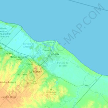
Name: Berisso topographic map, elevation, terrain.

Location: Berisso, Partido de Berisso, Buenos Aires, 1923, Argentina (-35.02886 -58.04287 -34.70886 -57.72287)

Average elevation: 20 ft

Minimum elevation: -3 ft

Maximum elevation: 121 ft

Gear up for your next adventure:

👖Convertible Hiking Pants - Versatile zip-off pants for changing altitudes and temperatures
📦Gear Storage Bags - Organize and protect outdoor equipment
👓Polarized Sunglasses - Outdoor sunglasses for glare reduction
🗺️Topographic Maps - Detailed topo maps for hiking, exploring and outdoor navigation
🧣Hiking Neck Gaiter - Multi‑use neck protection for outdoor weather

As an Amazon Associate, this site earns from qualifying purchases at no extra cost to you.