
Thank you for supporting this site ❤️
Make a donation
Make a donation
Gear up for your next adventure:
As an Amazon Associate, this site earns from qualifying purchases at no extra cost to you.
Ludney topographic map
Click on the map to display elevation.
Thank you for supporting this site ❤️
Make a donation
Make a donation
Gear up for your next adventure:
As an Amazon Associate, this site earns from qualifying purchases at no extra cost to you.
About this map
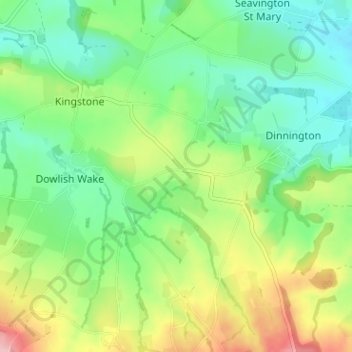
Name: Ludney topographic map, elevation, terrain.
Location: Ludney, Kingstone, Somerset, England, TA17 8TD, United Kingdom (50.88973 -2.89060 50.92973 -2.85060)
Average elevation: 292 ft
Minimum elevation: 118 ft
Maximum elevation: 620 ft
Thank you for supporting this site ❤️
Make a donation
Make a donation
Gear up for your next adventure:
As an Amazon Associate, this site earns from qualifying purchases at no extra cost to you.