
吴家营 topographic map
Interactive map
Click on the map to display elevation.
About this map
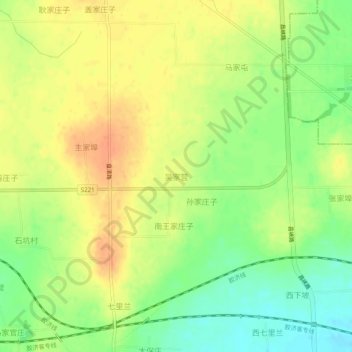
Name: 吴家营 topographic map, elevation, terrain.
Location: 吴家营, 潍坊市, 山东省, 中国 (36.53668 119.43520 36.57668 119.47520)
Average elevation: 180 ft
Minimum elevation: 102 ft
Maximum elevation: 243 ft
Other topographic maps
Click on a map to view its topography, its elevation and its terrain.