
潍坊市 topographic map
Interactive map
Click on the map to display elevation.
About this map
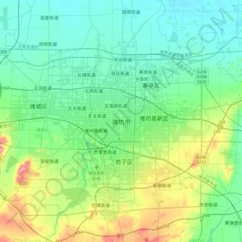
Name: 潍坊市 topographic map, elevation, terrain.
Location: 潍坊市, 奎文区, 潍坊市, 山东省, 261042, 中国 (36.54716 118.99574 36.86716 119.31574)
Average elevation: 138 ft
Minimum elevation: 13 ft
Maximum elevation: 551 ft
Other topographic maps
Click on a map to view its topography, its elevation and its terrain.