Geolocate

Lemon Township topographic map

Click on the map to display elevation.

About this map

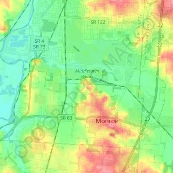
Name: Lemon Township topographic map, elevation, terrain.

Location: Lemon Township, Butler County, Ohio, United States (39.42753 -84.46425 39.49839 -84.34261)

Average elevation: 682 ft

Minimum elevation: 591 ft

Maximum elevation: 978 ft

Butler County trails, hiking, mountain biking, running and outdoor activities

Other topographic maps

Click on a map to view its topography, its elevation and its terrain.

South Highlands

United States > Ohio > Butler County > Middletown

Average elevation: 702 ft

Hughes

United States > Ohio > Butler County

Average elevation: 778 ft

Busenbark

United States > Ohio > Butler County

Average elevation: 663 ft

Williamsdale

United States > Ohio > Butler County

Average elevation: 633 ft

McGonigle

United States > Ohio > Butler County

Average elevation: 873 ft

Astoria

United States > Ohio > Butler County

Average elevation: 863 ft

West Chester

United States > Ohio > Butler County > West Chester

Average elevation: 758 ft

Gear up for your next adventure:

🔪Outdoor Multitools - Essential survival tools for gear repair and field use
🧥Men's Rain Shells - Premium waterproof and breathable jackets for mountain weather
GPS Sports Watch - GPS watch for running, hiking and training
🏕️Family Camping Gear - Essentials for group camping trips
👖Convertible Hiking Pants - Versatile zip-off pants for changing altitudes and temperatures

As an Amazon Associate, this site earns from qualifying purchases at no extra cost to you.