Geolocate

Mil Encinos topographic map

Click on the map to display elevation.

About this map

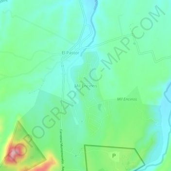
Name: Mil Encinos topographic map, elevation, terrain.

Location: Mil Encinos, Montemorelos, Nuevo León, Mexico (25.12246 -99.94632 25.16246 -99.90632)

Average elevation: 1,729 ft

Minimum elevation: 1,565 ft

Maximum elevation: 2,201 ft

Gear up for your next adventure:

🧭Outdoor Navigation Book - Learn advanced navigation skills
🗺️NatGeo Topo Maps - High-quality waterproof printed topographic maps of US Parks
🏕️Tent Footprint - Protect your tent base from wear
🎒Trail Energy Bars - High‑calorie bars for hiking energy
🧤Hiking Gloves - Protective gloves for rugged trails

As an Amazon Associate, this site earns from qualifying purchases at no extra cost to you.