
Make a donation
Gear up for your next adventure:
As an Amazon Associate, this site earns from qualifying purchases at no extra cost to you.
Willoughby topographic map
Click on the map to display elevation.
Make a donation
Gear up for your next adventure:
As an Amazon Associate, this site earns from qualifying purchases at no extra cost to you.
About this map
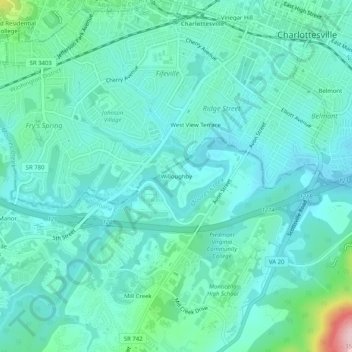
Name: Willoughby topographic map, elevation, terrain.
Location: Willoughby, Albemarle County, Virginia, 22903, United States (37.99320 -78.51557 38.03320 -78.47557)
Average elevation: 466 ft
Minimum elevation: 322 ft
Maximum elevation: 1,138 ft
Albemarle County trails, hiking, mountain biking, running and outdoor activities
Make a donation
Gear up for your next adventure:
As an Amazon Associate, this site earns from qualifying purchases at no extra cost to you.
Other topographic maps
Click on a map to view its topography, its elevation and its terrain.
Beaver Creek Park
United States > Virginia > Albemarle County > Charlottesville > Wickham Pond
Average elevation: 607 ft
Make a donation
Gear up for your next adventure:
As an Amazon Associate, this site earns from qualifying purchases at no extra cost to you.
Darden Towe Park
United States > Virginia > Albemarle County > Charlottesville > Franklin
Average elevation: 423 ft