Geolocate

Lahad Datu topographic map

Click on the map to display elevation.

About this map

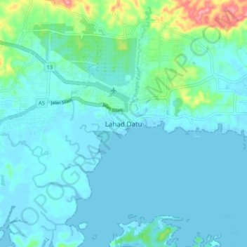
Name: Lahad Datu topographic map, elevation, terrain.

Location: Lahad Datu, Tawau Division, Sabah, 91100, Malaysia (4.98157 118.28755 5.06157 118.36755)

Average elevation: 56 ft

Minimum elevation: -3 ft

Maximum elevation: 384 ft

Gear up for your next adventure:

🥄Camping Utensil Set - Lightweight utensils for outdoor meals
🧭Compass with Lanyard - Easy‑carry compass for navigation
🗺️Topographic Maps - Detailed topo maps for hiking, exploring and outdoor navigation
🗺️NatGeo Topo Maps - High-quality waterproof printed topographic maps of US Parks
📻Weather Alert Radios - Stay informed of storm risks while off-the-grid

As an Amazon Associate, this site earns from qualifying purchases at no extra cost to you.