
解特阿热勒镇 topographic map
Interactive map
Click on the map to display elevation.
About this map
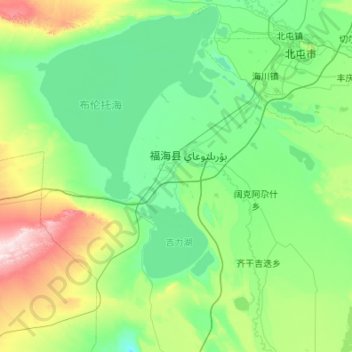
Name: 解特阿热勒镇 topographic map, elevation, terrain.
Location: 解特阿热勒镇, 福海县, 阿勒泰地区, 新疆维吾尔自治区, 836400, 中国 (46.69489 87.00897 47.43410 87.70322)
Average elevation: 1,880 ft
Minimum elevation: 1,424 ft
Maximum elevation: 4,088 ft
Other topographic maps
Click on a map to view its topography, its elevation and its terrain.