
Thank you for supporting this site ❤️
Make a donation
Make a donation
Gear up for your next adventure:
As an Amazon Associate, this site earns from qualifying purchases at no extra cost to you.
Valcieca topographic map
Click on the map to display elevation.
Thank you for supporting this site ❤️
Make a donation
Make a donation
Gear up for your next adventure:
As an Amazon Associate, this site earns from qualifying purchases at no extra cost to you.
About this map
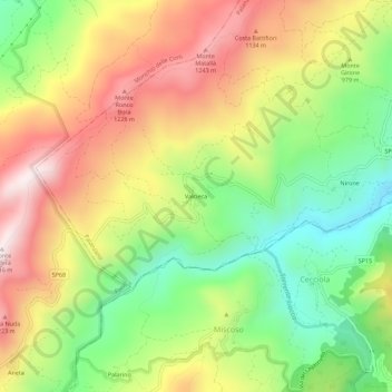
Name: Valcieca topographic map, elevation, terrain.
Location: Valcieca, Palanzano, Parma, Emilia-Romagna, Italia (44.37074 10.15044 44.41074 10.19044)
Average elevation: 3,087 ft
Minimum elevation: 2,031 ft
Maximum elevation: 4,268 ft
Thank you for supporting this site ❤️
Make a donation
Make a donation
Gear up for your next adventure:
As an Amazon Associate, this site earns from qualifying purchases at no extra cost to you.