
Keumiée topographic map
Interactive map
Click on the map to display elevation.
About this map
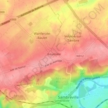
Name: Keumiée topographic map, elevation, terrain.
Location: Keumiée, Sambreville, Namur, Wallonie, 5060, Belgique (50.44551 4.57601 50.48551 4.61601)
Average elevation: 499 ft
Minimum elevation: 295 ft
Maximum elevation: 600 ft
Other topographic maps
Click on a map to view its topography, its elevation and its terrain.