Geolocate

Axbridge topographic map

Click on the map to display elevation.

About this map

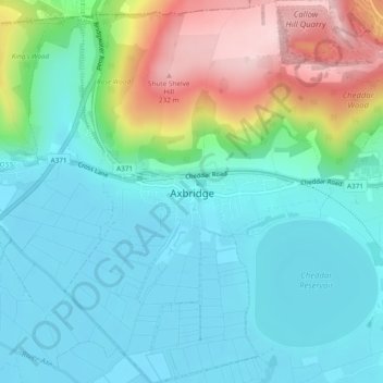
Name: Axbridge topographic map, elevation, terrain.

Location: Axbridge, Sedgemoor, Somerset, England, United Kingdom (51.27240 -2.83300 51.30197 -2.80015)

Average elevation: 220 ft

Minimum elevation: 10 ft

Maximum elevation: 791 ft

Other topographic maps

Click on a map to view its topography, its elevation and its terrain.

Highbridge

United Kingdom > England > Somerset > Sedgemoor > Highbridge

Average elevation: 20 ft

Gear up for your next adventure:

🪶Paracord Bracelet - Survival bracelet with built‑in tools
🧭GPS Watch Accessories - Bands and chargers for GPS watches
🧢Sun Protection Hats - Wide-brimmed and UPF-rated hats for high-altitude sun safety
🔥Fast-Boil Camping Stoves - Efficient cooking systems for quick trail meals
🔪Outdoor Multitools - Essential survival tools for gear repair and field use

As an Amazon Associate, this site earns from qualifying purchases at no extra cost to you.