

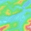
Fall topographic map
Click on the map to display elevation.
Fall
Das neue Dorf namens Fall liegt auf einer Höhe von 773 Metern, somit 6 Meter über dem Stauziel des Sylvensteinspeichers. Die Einwohnerzahl betrug 113 zum Stand der letzten Volkszählung am 25. Mai 1987, bei 41 Wohneinheiten in 22 Gebäuden mit Wohnraum. Müllers großes deutsches Ortsbuch von 2012 gibt 136 Einwohner an. Am 20. März 2015 waren im Dorf 111 Personen mit Hauptwohnsitz bzw. einzigem Wohnsitz gemeldet.
About this map

Name: Fall topographic map, elevation, terrain.
Average elevation: 2,953 ft
Minimum elevation: 2,369 ft
Maximum elevation: 5,374 ft
Other topographic maps
Click on a map to view its topography, its elevation and its terrain.
Sylvensteinspeicher
Deutschland > Bayern > Landkreis Bad Tölz-Wolfratshausen > Lenggries > Fall
Der Stausee wurde nach dem Sylvenstein benannt, einem Felsrücken, der im oberen Isartal eine natürliche Engstelle nach Osten begrenzt. Die westliche Begrenzung ist das felsige Hennenköpfl. Der Sylvensteinsee ist auch ein Ausflugsziel und Erholungsgebiet. Im See versunken liegt das ehemalige Dorf Fall, das…
Average elevation: 3,133 ft