Geolocate

Orchha topographic map

Click on the map to display elevation.

About this map

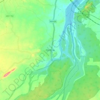
Name: Orchha topographic map, elevation, terrain.

Location: Orchha, Orchha Tahsil, Niwari, Madhya Pradesh, 472246, India (25.31287 78.60025 25.39287 78.68025)

Average elevation: 745 ft

Minimum elevation: 630 ft

Maximum elevation: 1,007 ft

Gear up for your next adventure:

🌲Outdoor Survival Books - Best books on survival skills
🕶️Glacier Sunglasses - Side shields to protect eyes from high-altitude snow glare
🎒Day Hiking Backpack - Lightweight backpack perfect for day trips and outdoor adventures
🔊Portable Camp Speaker - Music and alerts at camp
🖼️Topo Map Wall Art - Decorative topographic prints of famous peaks and regions

As an Amazon Associate, this site earns from qualifying purchases at no extra cost to you.