Geolocate

Varkhand topographic map

Click on the map to display elevation.

About this map

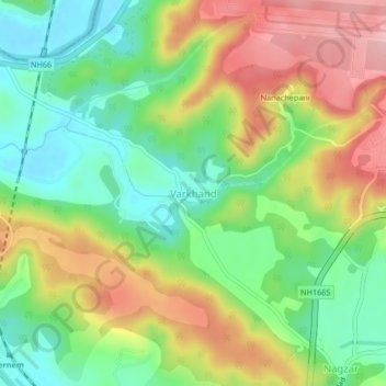
Name: Varkhand topographic map, elevation, terrain.

Location: Varkhand, Pernem, North Goa, Goa, India (15.70576 73.81669 15.74576 73.85669)

Average elevation: 240 ft

Minimum elevation: 0 ft

Maximum elevation: 558 ft

Other topographic maps

Click on a map to view its topography, its elevation and its terrain.

Morjim Beach

India > Goa > Pernem

Average elevation: 10 ft

Arambol Sweet Water Lake

India > Goa > Pernem > Arambol

Average elevation: 82 ft

Gear up for your next adventure:

📚Navigation Handbooks - Master the art of reading topographic maps and using a compass
🌎3D Topographic Globes - Raised relief globes for a tactile understanding of geography
👖Convertible Hiking Pants - Versatile zip-off pants for changing altitudes and temperatures
🥾Women's Hiking Boots - Top-rated trail boots with ankle support and superior grip
🥤Water Filter Bottle - All‑in‑one filter bottle for safe hydration

As an Amazon Associate, this site earns from qualifying purchases at no extra cost to you.