
Thank you for supporting this site ❤️
Make a donation
Make a donation
Gear up for your next adventure:
As an Amazon Associate, this site earns from qualifying purchases at no extra cost to you.
Ikedjane topographic map
Click on the map to display elevation.
Thank you for supporting this site ❤️
Make a donation
Make a donation
Gear up for your next adventure:
As an Amazon Associate, this site earns from qualifying purchases at no extra cost to you.
About this map
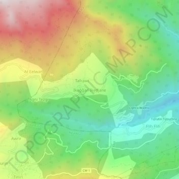
Name: Ikedjane topographic map, elevation, terrain.
Location: Ikedjane, Tifra, Daïra Sidi-Aïch, Béjaïa, 06412, Algérie (36.62826 4.62361 36.66826 4.66361)
Average elevation: 2,336 ft
Minimum elevation: 971 ft
Maximum elevation: 4,295 ft
Thank you for supporting this site ❤️
Make a donation
Make a donation
Gear up for your next adventure:
As an Amazon Associate, this site earns from qualifying purchases at no extra cost to you.