Geolocate

Oakpark topographic map

Click on the map to display elevation.

About this map

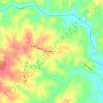
Name: Oakpark topographic map, elevation, terrain.

Location: Oakpark, Madison County, Virginia, 22730, United States (38.34680 -78.18000 38.38680 -78.14000)

Average elevation: 440 ft

Minimum elevation: 325 ft

Maximum elevation: 554 ft

Madison County trails, hiking, mountain biking, running and outdoor activities

Other topographic maps

Click on a map to view its topography, its elevation and its terrain.

Blakey Ridge

United States > Virginia > Madison County

Average elevation: 1,362 ft

Gear up for your next adventure:

🌲Outdoor Survival Books - Best books on survival skills
🛡️Insect Repellent - Protection against bugs during outdoor activities
🥄Camping Utensil Set - Lightweight utensils for outdoor meals
🚑Emergency Bivvies - Heat-reflective sleeping bags for survival situations
📡Handheld GPS Device - Reliable handheld GPS for outdoor navigation

As an Amazon Associate, this site earns from qualifying purchases at no extra cost to you.