

Schwanberg topographic map
Click on the map to display elevation.
Schwanberg
Der Schwanberg erhebt sich am westlichen Rand des Steigerwaldes bis zu einer Höhe von 474 m ü. NHN. Er ist etwas höher als die benachbarten Höhenzüge und von ihnen weitgehend getrennt; außerdem ragt er weit in die vorgelagerte flachere Landschaft am Main hinein, die 200 Höhenmeter tiefer liegt (sogenanntes Schwanbergvorland). Dadurch wirkt der Berg vor allem von der Westseite sehr markant und bietet eine sehr gute Aussicht, weshalb der Berg auch vom 35 Kilometer nördlich gelegenen Schweinfurt noch gut zu sehen ist. Auf dem Gipfel befinden sich Sendeanlagen.
About this map
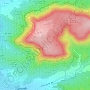
Name: Schwanberg topographic map, elevation, terrain.
Average elevation: 1,142 ft
Minimum elevation: 837 ft
Maximum elevation: 1,575 ft
Other topographic maps
Click on a map to view its topography, its elevation and its terrain.
