Geolocate

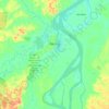
Iquitos topographic map

Click on the map to display elevation.

About this map
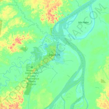
Name: Iquitos topographic map, elevation, terrain.

Location: Iquitos, Province of Maynas, Loreto, 16002, Peru (-3.90937 -73.40441 -3.58937 -73.08441)

Average elevation: 302 ft

Minimum elevation: 256 ft

Maximum elevation: 456 ft

Other topographic maps

Click on a map to view its topography, its elevation and its terrain.
Iquitos

Peru > Loreto

Average elevation: 308 ft

Nauta

Peru > Loreto

Average elevation: 381 ft

Pebas

Peru > Loreto

Average elevation: 348 ft

Contamana

Peru > Loreto

Average elevation: 722 ft

Yurimaguas

Peru > Loreto

Average elevation: 581 ft

Iquitos

Peru > Loreto

Average elevation: 308 ft

Requena

Peru > Loreto

Average elevation: 381 ft

Iquitos

Peru > Loreto

Average elevation: 308 ft

Province of Requena

Peru > Loreto

Average elevation: 515 ft

Yurimaguas

Peru > Loreto

Average elevation: 581 ft

Morona

Peru > Loreto

Average elevation: 1,204 ft

Gear up for your next adventure:

🛡️Insect Repellent - Protection against bugs during outdoor activities
🚁Photography Drones - Capture stunning aerial views of landforms and topography
🎒Hydration Pack - Hands‑free water reservoir for long hikes
🛰️Handheld GPS Units - Professional satellite navigators for precise backcountry mapping
😴Insulated Sleeping Pads - Compact and warm pads for high-elevation camping

As an Amazon Associate, this site earns from qualifying purchases at no extra cost to you.