Geolocate

Manarcadu topographic map

Interactive map

Click on the map to display elevation.

About this map

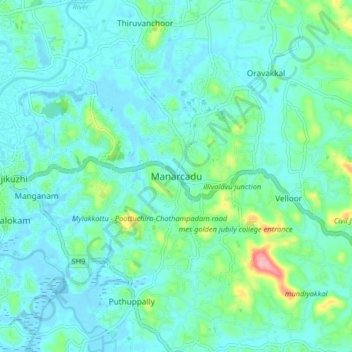
Name: Manarcadu topographic map, elevation, terrain.

Location: Manarcadu, Kottayam, Kerala, 686019, India (9.54778 76.54227 9.62778 76.62227)

Average elevation: 75 ft

Minimum elevation: -7 ft

Maximum elevation: 423 ft

Other topographic maps

Click on a map to view its topography, its elevation and its terrain.

Pampady

India > Kerala > Kottayam

Pampady, Kottayam, Kottayam District, Kerala, 686502, India

Average elevation: 180 ft

Kumarakom

India > Kerala > Kottayam > Kumarakom

Kumarakom, Kottayam, Kerala, 686563, India

Average elevation: 7 ft

Nellikunnu

India > Kerala > Kottayam > Mattakkara

Nellikunnu, Mattakkara, Kottayam, Kerala, India

Average elevation: 164 ft

Kottayam

India > Kerala > Kottayam

Kottayam, Kottayam District, Kerala, 686001, India

Average elevation: 62 ft