
Thank you for supporting this site ❤️
Make a donation
Make a donation
Gear up for your next adventure:
As an Amazon Associate, this site earns from qualifying purchases at no extra cost to you.
Thedford topographic map
Click on the map to display elevation.
Thank you for supporting this site ❤️
Make a donation
Make a donation
Gear up for your next adventure:
As an Amazon Associate, this site earns from qualifying purchases at no extra cost to you.
About this map
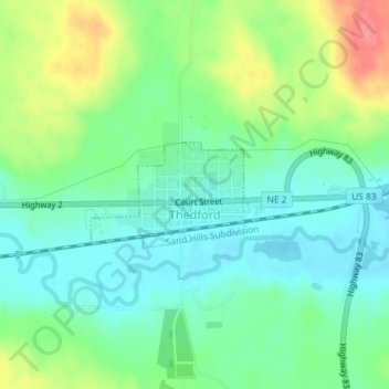
Name: Thedford topographic map, elevation, terrain.
Location: Thedford, Thomas County, Nebraska, 69166, United States (41.97520 -100.58387 41.98256 -100.56955)
Average elevation: 2,907 ft
Minimum elevation: 2,825 ft
Maximum elevation: 3,068 ft
Thomas County trails, hiking, mountain biking, running and outdoor activities
Thank you for supporting this site ❤️
Make a donation
Make a donation
Gear up for your next adventure:
As an Amazon Associate, this site earns from qualifying purchases at no extra cost to you.