
Thank you for supporting this site ❤️
Make a donation
Make a donation
Gear up for your next adventure:
As an Amazon Associate, this site earns from qualifying purchases at no extra cost to you.
Salinas topographic map
Click on the map to display elevation.
Thank you for supporting this site ❤️
Make a donation
Make a donation
Gear up for your next adventure:
As an Amazon Associate, this site earns from qualifying purchases at no extra cost to you.
About this map
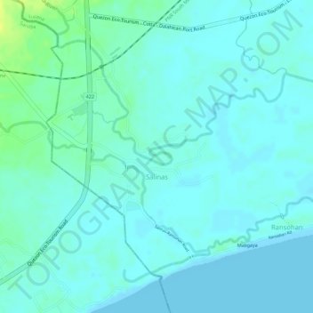
Name: Salinas topographic map, elevation, terrain.
Location: Salinas, Lucena, 2nd District, Calabarzon, 4301, Philippines (13.89090 121.57476 13.91090 121.60157)
Average elevation: 16 ft
Minimum elevation: 0 ft
Maximum elevation: 66 ft
Thank you for supporting this site ❤️
Make a donation
Make a donation
Gear up for your next adventure:
As an Amazon Associate, this site earns from qualifying purchases at no extra cost to you.