Geolocate

Orchard topographic map

Click on the map to display elevation.

About this map

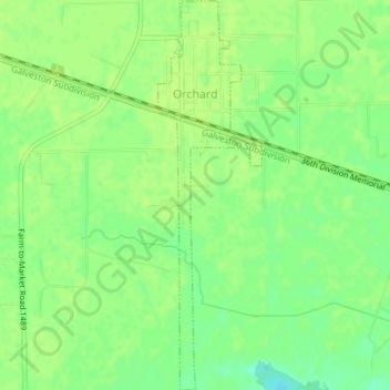
Name: Orchard topographic map, elevation, terrain.

Location: Orchard, Fort Bend County, Texas, 77464, United States (29.57948 -95.97327 29.61185 -95.96328)

Average elevation: 125 ft

Minimum elevation: 92 ft

Maximum elevation: 135 ft

Fort Bend County trails, hiking, mountain biking, running and outdoor activities

Other topographic maps

Click on a map to view its topography, its elevation and its terrain.

Townewest

United States > Texas > Fort Bend County

Average elevation: 92 ft

Pecan Grove

United States > Texas > Fort Bend County

Average elevation: 89 ft

Sugar Land

United States > Texas > Fort Bend County > Sugar Land

Average elevation: 82 ft

Mission Bend

United States > Texas > Fort Bend County

Average elevation: 95 ft

Tavener

United States > Texas > Fort Bend County

Average elevation: 118 ft

Fresno

United States > Texas > Fort Bend County

Average elevation: 69 ft

Duke

United States > Texas > Fort Bend County > Arcola

Average elevation: 66 ft

Thompsons

United States > Texas > Fort Bend County > Thompsons

Average elevation: 66 ft

Palmetto

United States > Texas > Fort Bend County

Average elevation: 72 ft

Gear up for your next adventure:

🔋Rechargeable Batteries - Power up your outdoor devices
📚Navigation Handbooks - Master the art of reading topographic maps and using a compass
🔌USB Car Charger - Car charger for on‑the‑go power needs
🛠️Outdoor Gear Repair Kit - Essential tools to fix gear on the trail
🧭Map Reading Tools - Tools and kits for map navigation

As an Amazon Associate, this site earns from qualifying purchases at no extra cost to you.