

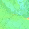
Grad Našice topographic map
Click on the map to display elevation.
About this map

Name: Grad Našice topographic map, elevation, terrain.
Location: Grad Našice, Osijek-Baranja County, 31500, Croatia (45.36851 17.96010 45.58173 18.21599)
Average elevation: 528 ft
Minimum elevation: 285 ft
Maximum elevation: 1,716 ft
Other topographic maps
Click on a map to view its topography, its elevation and its terrain.


Osijek
Croatia > Osijek-Baranja County > Osijek
Osijek (Croatian pronunciation: (listen)) is the fourth largest city in Croatia with a population of 108,048 in 2011. It is the largest city and the economic and cultural centre of the eastern Croatian region of Slavonia, as well as the administrative centre of Osijek-Baranja County. Osijek is located on the…
Average elevation: 285 ft