Geolocate

Five Points topographic map

Click on the map to display elevation.

About this map

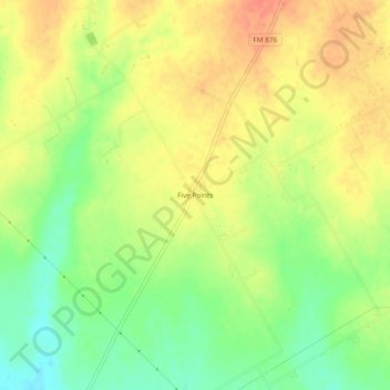
Name: Five Points topographic map, elevation, terrain.

Location: Five Points, Ellis County, Texas, 76041, United States (32.25820 -96.92139 32.29820 -96.88139)

Average elevation: 584 ft

Minimum elevation: 499 ft

Maximum elevation: 653 ft

Ellis County trails, hiking, mountain biking, running and outdoor activities

Other topographic maps

Click on a map to view its topography, its elevation and its terrain.

Maypearl

United States > Texas > Ellis County

Average elevation: 574 ft

Milford

United States > Texas > Ellis County

Average elevation: 614 ft

Italy

United States > Texas > Ellis County

Average elevation: 568 ft

Gear up for your next adventure:

🧺Microfiber Travel Towels - Compact and fast-drying towels for trail use
👓Polarized Sunglasses - Outdoor sunglasses for glare reduction
🛶Inflatable Kayak - Portable kayak for rivers, lakes, and expeditions
📶Vehicle Signal Boosters - Improve reception in rural areas while driving to trailheads
🛠️Outdoor Gear Repair Kit - Essential tools to fix gear on the trail

As an Amazon Associate, this site earns from qualifying purchases at no extra cost to you.