Geolocate

Barns Green topographic map

Click on the map to display elevation.

About this map

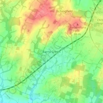
Name: Barns Green topographic map, elevation, terrain.

Location: Barns Green, Horsham, West Sussex, England, RH13 0PL, United Kingdom (51.01114 -0.41406 51.05114 -0.37406)

Average elevation: 161 ft

Minimum elevation: 62 ft

Maximum elevation: 292 ft

Gear up for your next adventure:

🔦LED Headlamp - Bright and durable LED headlamp for night navigation
🔭Compact Binoculars - HD vision for scouting terrain and identifying distant landmarks
🧭Hiking Compass - Precision compass for reliable navigation in the wilderness
🪶Camping Sleeping Pad - Comfortable sleeping pad for backpacking
🛏️Cold Weather Sleeping Bag - Warm sleeping bag for cold conditions

As an Amazon Associate, this site earns from qualifying purchases at no extra cost to you.