Make a donation
Gear up for your next adventure:
As an Amazon Associate, this site earns from qualifying purchases at no extra cost to you.
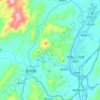
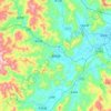
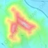
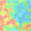
Jianning County topographic map
Click on the map to display elevation.
Make a donation
Gear up for your next adventure:
As an Amazon Associate, this site earns from qualifying purchases at no extra cost to you.
About this map
Name: Jianning County topographic map, elevation, terrain.
Location: Jianning County, Sanming City, Fujian, China (26.53969 116.50469 27.10464 117.06465)
Average elevation: 1,686 ft
Minimum elevation: 308 ft
Maximum elevation: 5,997 ft
Make a donation
Gear up for your next adventure:
As an Amazon Associate, this site earns from qualifying purchases at no extra cost to you.
Other topographic maps
Click on a map to view its topography, its elevation and its terrain.
Make a donation
Gear up for your next adventure:
As an Amazon Associate, this site earns from qualifying purchases at no extra cost to you.
Make a donation
Gear up for your next adventure:
As an Amazon Associate, this site earns from qualifying purchases at no extra cost to you.
Make a donation
Gear up for your next adventure:
As an Amazon Associate, this site earns from qualifying purchases at no extra cost to you.
Make a donation
Gear up for your next adventure:
As an Amazon Associate, this site earns from qualifying purchases at no extra cost to you.
Make a donation
Gear up for your next adventure:
As an Amazon Associate, this site earns from qualifying purchases at no extra cost to you.
Make a donation
Gear up for your next adventure:
As an Amazon Associate, this site earns from qualifying purchases at no extra cost to you.
Sansha
China > Fujian > Xiapu County
The land around Sansha is mostly hilly, but to the south it is flat. To the southeast, the sea is closest to Sansha. The highest point in the vicinity has an elevation of 516 meters and is 2.3 km northwest of Sansha. Sansha is the largest town in the area. In the region around Sansha, islands are unusually…
Average elevation: 259 ft