
Make a donation
Gear up for your next adventure:
As an Amazon Associate, this site earns from qualifying purchases at no extra cost to you.
Heepen topographic map
Click on the map to display elevation.
Make a donation
Gear up for your next adventure:
As an Amazon Associate, this site earns from qualifying purchases at no extra cost to you.
Heepen
Im Süden grenzt der Stadtbezirk Heepen an den Stadtbezirk Stieghorst, im Westen an den Stadtbezirk Mitte, im Nordwesten an den Stadtbezirk Schildesche sowie an Vilsendorf aus dem Stadtbezirk Jöllenbeck. Den Norden begrenzt die Stadt Herford (Kreis Herford) und den Osten Bad Salzuflen sowie Leopoldshöhe (Kreis Lippe).
Make a donation
Gear up for your next adventure:
As an Amazon Associate, this site earns from qualifying purchases at no extra cost to you.
About this map
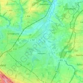
Name: Heepen topographic map, elevation, terrain.
Location: Heepen, Bielefeld, Nordrhein-Westfalen, Deutschland (52.00012 8.56666 52.08924 8.66335)
Average elevation: 341 ft
Minimum elevation: 223 ft
Maximum elevation: 679 ft
Make a donation
Gear up for your next adventure:
As an Amazon Associate, this site earns from qualifying purchases at no extra cost to you.
Other topographic maps
Click on a map to view its topography, its elevation and its terrain.
Burg und Festung Sparrenberg
Deutschland > Nordrhein-Westfalen > Bielefeld
Um den Erhalt und die Sanierung der Anlage finanziell sicherzustellen, wurde die Aktion Ein Stein für die Burg initiiert, bei der gegen Geldspenden die Patenschaft für einen Stein in der Burgmauer übernommen werden konnte. Bei höheren Spendensummen war eine persönliche Gravur des Steins möglich.…
Average elevation: 476 ft
Make a donation
Gear up for your next adventure:
As an Amazon Associate, this site earns from qualifying purchases at no extra cost to you.