Geolocate

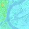
Creative Park topographic map

Click on the map to display elevation.

About this map

Name: Creative Park topographic map, elevation, terrain.

Location: Creative Park, Phường An Khánh, Thủ Đức, Ho Chi Minh City, Vietnam (10.77891 106.71187 10.78118 106.71317)

Average elevation: 20 ft

Minimum elevation: 0 ft

Maximum elevation: 115 ft

Other topographic maps

Click on a map to view its topography, its elevation and its terrain.

Phường Tam Bình

Vietnam > Thủ Đức

Average elevation: 39 ft

Thu Thiem Ward

Vietnam > Thủ Đức

Average elevation: 16 ft

District 1

Vietnam > Thủ Đức

Average elevation: 26 ft

Phường Tân Phú

Vietnam > Thủ Đức

Average elevation: 26 ft

Phường Thủ Đức

Vietnam > Thủ Đức

Average elevation: 33 ft

Phường Thủ Đức

Vietnam > Thủ Đức

Average elevation: 33 ft

Phường Thủ Đức

Vietnam > Thủ Đức

Average elevation: 33 ft

District 10

Vietnam > Thủ Đức

Average elevation: 30 ft

Phường Long Bình

Vietnam > Thủ Đức

Average elevation: 26 ft

Phường Thủ Đức

Vietnam > Thủ Đức

Average elevation: 33 ft

Phường Thủ Đức

Vietnam > Thủ Đức

Average elevation: 33 ft

District 10

Vietnam > Thủ Đức

Average elevation: 30 ft

Phường Tam Bình

Vietnam > Thủ Đức

Average elevation: 39 ft

Phường Diên Hồng

Vietnam > Thủ Đức

Average elevation: 30 ft

Phường Hiệp Bình

Vietnam > Thủ Đức

Average elevation: 10 ft

District 1

Vietnam > Thủ Đức

Average elevation: 26 ft

District 5

Vietnam > Thủ Đức

Average elevation: 26 ft

Gear up for your next adventure:

🧭Hiking Compass - Precision compass for reliable navigation in the wilderness
🎒Hydration Pack - Hands‑free water reservoir for long hikes
⛑️Personal Locator Beacon - Safety beacon for emergencies
📶Satellite Messenger - Communication device off‑grid
⛺Backpacking Tents - Weight-optimized shelters for multi-day topographic surveys

As an Amazon Associate, this site earns from qualifying purchases at no extra cost to you.