
Thank you for supporting this site ❤️
Make a donation
Make a donation
Gear up for your next adventure:
As an Amazon Associate, this site earns from qualifying purchases at no extra cost to you.
Bouhamdoune topographic map
Click on the map to display elevation.
Thank you for supporting this site ❤️
Make a donation
Make a donation
Gear up for your next adventure:
As an Amazon Associate, this site earns from qualifying purchases at no extra cost to you.
About this map
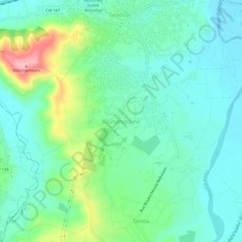
Name: Bouhamdoune topographic map, elevation, terrain.
Location: Bouhamdoune, Emir Abdelkader, Daïra Taher, Jijel, 18038, Algérie (36.76450 5.82292 36.80450 5.86292)
Average elevation: 121 ft
Minimum elevation: -3 ft
Maximum elevation: 469 ft
Thank you for supporting this site ❤️
Make a donation
Make a donation
Gear up for your next adventure:
As an Amazon Associate, this site earns from qualifying purchases at no extra cost to you.