
Thank you for supporting this site ❤️
Make a donation
Make a donation
Gear up for your next adventure:
As an Amazon Associate, this site earns from qualifying purchases at no extra cost to you.
Gehörde topographic map
Click on the map to display elevation.
Thank you for supporting this site ❤️
Make a donation
Make a donation
Gear up for your next adventure:
As an Amazon Associate, this site earns from qualifying purchases at no extra cost to you.
About this map
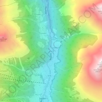
Name: Gehörde topographic map, elevation, terrain.
Location: Gehörde, Sölden, Bezirk Imst, Tyrol, 6450, Austria (46.96523 10.99201 47.00523 11.03201)
Average elevation: 6,280 ft
Minimum elevation: 4,213 ft
Maximum elevation: 9,672 ft
Thank you for supporting this site ❤️
Make a donation
Make a donation
Gear up for your next adventure:
As an Amazon Associate, this site earns from qualifying purchases at no extra cost to you.