
Make a donation
Gear up for your next adventure:
As an Amazon Associate, this site earns from qualifying purchases at no extra cost to you.
Glendale topographic map
Click on the map to display elevation.
Make a donation
Gear up for your next adventure:
As an Amazon Associate, this site earns from qualifying purchases at no extra cost to you.
About this map
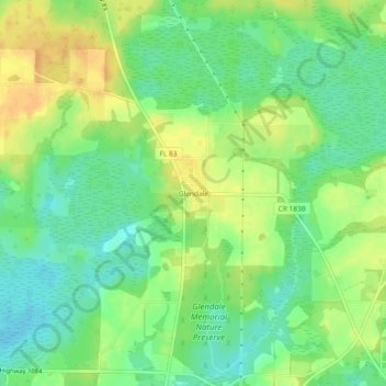
Name: Glendale topographic map, elevation, terrain.
Location: Glendale, Walton County, Florida, United States (30.84296 -86.13439 30.88296 -86.09439)
Average elevation: 266 ft
Minimum elevation: 213 ft
Maximum elevation: 325 ft
Walton County trails, hiking, mountain biking, running and outdoor activities
Make a donation
Gear up for your next adventure:
As an Amazon Associate, this site earns from qualifying purchases at no extra cost to you.
Other topographic maps
Click on a map to view its topography, its elevation and its terrain.
Choctaw Beach Community Center Park
United States > Florida > Walton County > Freeport > Choctaw Beach
Average elevation: 23 ft