Geolocate

Gesher topographic map

Click on the map to display elevation.

About this map

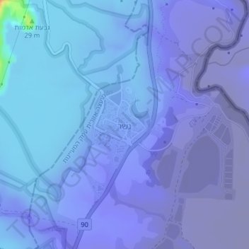
Name: Gesher topographic map, elevation, terrain.

Location: Gesher, Jezreel Subdistrict, North District, Israel (32.61645 35.54816 32.62525 35.55554)

Average elevation: -587 ft

Minimum elevation: -850 ft

Maximum elevation: 135 ft

Gear up for your next adventure:

GPS Sports Watch - GPS watch for running, hiking and training
📦Dry Bags Set - Waterproof storage for electronics and clothes
📡Handheld GPS Device - Reliable handheld GPS for outdoor navigation
🌡️Portable Weather Meter - Track weather conditions on the trail
🗻Climbing Gear Basics - Essential gear for beginner climbers

As an Amazon Associate, this site earns from qualifying purchases at no extra cost to you.