
Thank you for supporting this site ❤️
Make a donation
Make a donation
Gear up for your next adventure:
As an Amazon Associate, this site earns from qualifying purchases at no extra cost to you.
Aghrib topographic map
Click on the map to display elevation.
Thank you for supporting this site ❤️
Make a donation
Make a donation
Gear up for your next adventure:
As an Amazon Associate, this site earns from qualifying purchases at no extra cost to you.
About this map
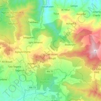
Name: Aghrib topographic map, elevation, terrain.
Location: Aghrib, Azeffoun District, Tizi Ouzou, 15022, Algeria (36.76913 4.26850 36.87015 4.41604)
Average elevation: 1,398 ft
Minimum elevation: 131 ft
Maximum elevation: 3,163 ft
Thank you for supporting this site ❤️
Make a donation
Make a donation
Gear up for your next adventure:
As an Amazon Associate, this site earns from qualifying purchases at no extra cost to you.