Geolocate

Limiñón topographic map

Click on the map to display elevation.

About this map

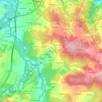
Name: Limiñón topographic map, elevation, terrain.

Location: Limiñón, Abegondo, La Coruña, Galicia, 15389, España (43.22804 -8.25510 43.26804 -8.21510)

Average elevation: 361 ft

Minimum elevation: 43 ft

Maximum elevation: 696 ft

Gear up for your next adventure:

🧦Hiking Socks - Comfortable socks to prevent blisters on long hikes
🥾Hiking Shoes - Durable and comfortable shoes for trail hiking
📱Solar Portable Charger - Solar power bank for charging devices off‑grid
🎒Waterproof Dry Bags - Keep your electronics and maps dry inside your pack
🪓Survival Multi‑Tool - Versatile tool for camp and trail tasks

As an Amazon Associate, this site earns from qualifying purchases at no extra cost to you.